Struve Geodetic Arc
Tuesday, 21st September 2010 by Ian Brown
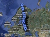
The Struve Geodetic Arc was a network of triangulation points developed in the 19th century, in an attempt to accurately calculate the size and shape of our planet. 34 of the original 265 points are clearly marked and were recognised as a World Heritage Site in 2005.
Friedrich Georg Wilhelm von Struve was member of a family of prominent astronomers1. While the majority of his work involved the study of astronomical bodies, he also turned his attentions to geodetic surveying - the measurement and representation of the Earth.
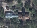
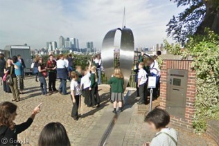
He studied at the University of Tartu in Estonia and established the first of his triangulation points at the observatory in that town. There is a large stone monument just to the north of the main building.
Further locations were established roughly along a meridian line originating in Tartu and spanning almost 3,000km. The majority of the sites were hill- or mountain-tops, or other prominent points of land. This wide range of triangulation points would have allowed accurate calculations of the size of the whole planet.
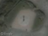
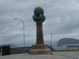
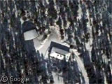
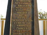
The 265 locations were - at that time - in only two countries: the Sweden-Norway Union and the Russian Empire. The intervening years have seen these two disintegrate into ten separate countries. Most of the 34 locations which make up the World Heritage Site are marked by monuments of some kind. The northernmost point is in Hammerfest, Norway. It's a low-res area on Google maps, but the monument is worth a closer look.
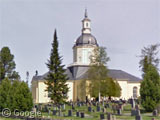
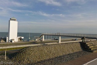
In Tornio, northern Finland, the quite beautiful Alatornion kirkko was the only building - other than the Tartu observatory - that was used as a triangulation point.
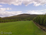
Further south in Finland, Aavasaksa is a small hill also used as a triangulation point. At the top there is a hunting lodge used by leaders of the Russian Empire. It is currently in use as a cafe and there is a monument consisting of a large boulder surrounded by an iron representation of the globe.
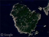
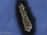
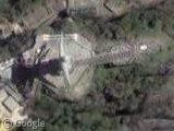
In the Baltic Sea, points were located on two islands: the highest point on Finland's Mustaviiri, and a hill-top on Russia's Gogland.
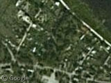
The village of Jekabpils in Latvia has a park named after Struve at the location of the triangulation point.
The majority of points to the south of the Arc - in Lithuania, Belarus, Moldova and Ukraine - are marked by small monuments, in rural areas covered by low-res imagery, so there's not much to see on satellite images. If you're curious, you can find many of the locations marked on this Google Maps interface.
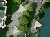
The southernmost monument is in what appears to be a housing development in the Ukrainian town of Stara Nekrasivka,
Wikipedia has a bit more information, while the Wikidot entry has a detailed list and map of all 265 triangulation points, along with photos of many of the World Heritage locations.
-
There is an asteroid named after him and two other family members, while other relatives were commemorated in the naming of a crater on the moon. ↩︎
About the author
Ian Brown lives in Ottawa, Canada, and spends his spare time perusing maps to find new routes to ride on his orange bicycle.
Sharing statistics
Share this site