Uunartoq Qeqertaq (Island Week 6)
Tuesday, 22nd November 2011 by Ian Brown
We often hear that global warming and rising sea levels will lead to the disappearance of low-lying islands such as the Maldives. However, climate change is also having the opposite effect - revealing islands that were previously unknown. The most notable example of this is Greenland's Uunartoq Qeqertaq.
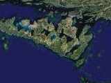
Uunartoq Qeqertaq (Greenlandic for The Warming Island) lies a few hundred metres off the northern tip of Liverpool Land, a peninsula on Greenland's eastern coast. Virtually all historical observations showed glacial ice connecting the distinctive W-shaped land form to the mainland, and geographers assumed that it was just an extension of the peninsula. Zooming out in Google Maps reveals older imagery with the ice still present.
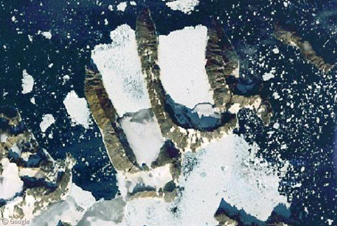
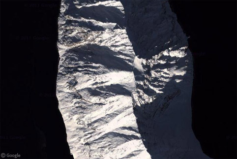
Within the past few years the ice bridge connecting the island to the mainland melted, revealing a strait of open water. The southern part of the island has a mountainous ridge which casts quite a spectacular shadow!
Controversy surrounds the island, with both sides of the climate debate claiming it as proof that their theories are correct. The first hint that it might be a separate island was published in the 1950s when photographer Ernst Hofer surveyed the area and showed the W shape not linked to the mainland. Those who don't believe in climate change point to this 'evidence' from more than 50 years ago to try to prove that recent changes cannot be blamed on global warming. However others believe that Hofer's map was inaccurate, with clear errors found in surrounding locations.
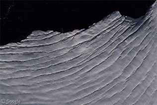
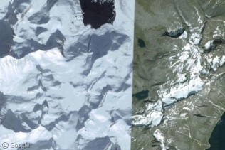
Climate change believers blame global warming for the significant and well-documented reduction in ice coverage in the region starting about ten years ago. Uunartoq Qeqertaq was confirmed to be a separate island by explorer Dennis Schmitt in 2005. His observations were supported by a comparison of US Geological Survey images. Google's images reveal icebergs and interesting striation of ice in one of the bays.
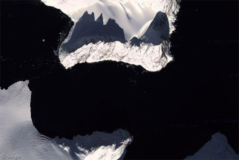
Each arm of the W is several kilometres long and over millennia the rock has been formed by ice into narrow peaks which give a lovely interplay between light and shadow when seen from above.
Controversy continued earlier this year when The Times Atlas of the World published a new map of Greenland. While it correctly showed Uunartoq Qeqertaq as an island, the map also depicted an overall 15% reduction in ice coverage. This vastly overstated the true decrease (which was about 2%) and gave climate skeptics more ammunition to argue that global warming scientists are incorrect.
Putting aside any debate, as the ice continues to melt we can expect to see more 'Warming Islands' appearing off Greenland and in other ice-covered areas of the world. Read more about this story at Science Magazine, and learn more about Uunartoq Qeqertaq at Wikipedia and the New York Times.
About the author
Ian Brown lives in Ottawa, Canada, and spends his spare time perusing maps to find new routes to ride on his orange bicycle.
You missed the birth of new islands, too.