Western Sahara Large Type
Monday, 14th August 2006 by Alex Turnbull
Despite Western Sahara being one of the most sparsely populated territories in the world (just over 1 person per square kilometre) Morocco and the Sahrawi Arab Democratic Republic (SADR) have been fighting since 1975 about who should control this territory.
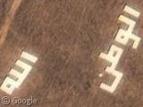
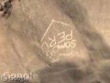
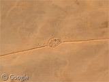
Western Sahara has no railways and only 6,200km of roads, but they do have some rather cool large type which (according to our submitter) translates to 'Allah, the Nation, the King' - which by all accounts is the motto of the Moroccan Monarchy. It seems to be right next to some sort of encampment and looks to be right on the border of Moroccan and SADR territory.
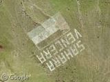
Spain was in charge here prior to '75, and over on nearby Gran Canaria there's an image of the SADR's version of the Western Sahara flag with text in Spanish that reads "Sahara Vencera", literally "Sahara Will Win". However, according to Flagspot this image might well be reversed from its intended direction... Suspicious methinks.
Thanks to Uri and Virtual Globetrotting.
thanks for another nice find!!
Actually it’s still considered “disputed territory” ( http://euphemize.net/wordpress/archives/2004/10/27/thesis/ ). In fact the Moroccons have not yet allowed the free and fair referendum ala East Timor in the region. Not to be unexpected though.
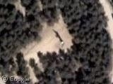
They might not have any railways, but they do have state-f-the-art monorail!
https://www.googlesightseeing.com/maps?p=&c=&t=k&hl=en&ll=26.96269,-13.339258&z=18
Seriously though; does anyone have a clue what this is?
koen – you just beat me to it!
See my next post for the full explanation 😀
Ah, thanks for that!
I’m not quite sure what’s cooler: The longest conveyor belt or a monorail in the middle of the desert.
The lettering in Gran Canaria is facing the “right way” if you are a Spanish jet flying out on patrol in a South Easterly direction…
Nice find. But the text (which is the Moroccan motto, as you said) is not to the east of the barrier (the “Moroccan wall”) that separates the two halves of the country, it’s just to the left (i.e. in Moroccan-occupied territory). If you zoom out, you find that this view is from the outskirts of Guelta Zemmur, which is (nowadays) a major Moroccan military & communications base, serving the barrier and the forces stationed there. It is just to the left of the wall, on the level of Bi’r Mughrayn in Mauritania. Actually, snooping around, one can still see craters pockmarking the area, from earlier battles and Polisario long-distance shelling during the 80s.
About the way the Sahrawi flag is supposed to be turned, don’t mind what Flagspot says. That’s a flagspotters’ urban legend. It can go anyway people pleases, a refugee nation (especially one which is bilingual in both left-to-right Spanish and right-to-left Arabic) has more important things on its mind.