Yukon Ho! Part 2: The Dempster Highway
Tuesday, 1st March 2011 by Kyle Kusch
We continue our Street View barnstorming tour of Yukon today as we follow the cameras on their 671 km (417 mile) odyssey north along the beautiful, desolate Dempster Highway, which was built in 1979 to connect the remote Mackenzie Delta in the Northwest Territories to the rest of Canada.
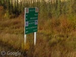
The road begins 25 miles (40 km) east of Dawson City, the endpoint of our journey in Part One.
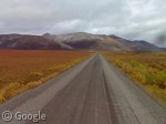
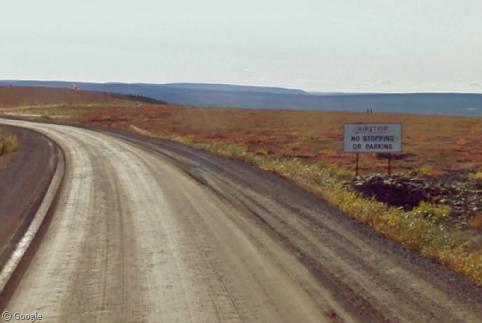
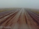
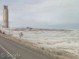
The vast majority of the road is unpaved, single-line, and dusty, as it is built upon a gravel berm sunk into the ground to insulate the roadbed from the permafrost below. Trees become smaller and smaller the further north you go. Most of the first few dozen kilometres carry on in this fashion.
![]()
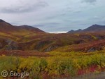
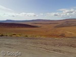
Not much to it, right? Not exactly. Eventually, the trees disappear almost entirely as the Dempster climbs into Tombstone Territorial Park, opening up the landscape and presenting lush green, yellow and red colours along the hillside as mountains rise out of the tundra grasses:
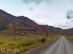
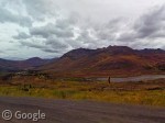
200 km (120 miles) from the start, the Ogilvie Mountains rise like a wall out of the plains. Further up the highway, Sapper Hill presents a daunting task for climbers.
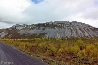
Out on the plains, trees struggle to survive in the high latitudes with no protection from the wind.

One thing noticeable along the Dempster is the lack of tourist services. It is 269 km (167 miles) to the only filling station and motel along the Yukon portion of the highway at Eagle Plains, where we catch the lead Street View car nipping off the road for a break. In remote climes such as this where there are no emergency services, it may come as a shock to some that certain portions of the road must double as airstrips.
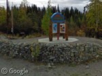
As it heads out of Yukon and into the Northwest Territories, the Dempster crosses over the Richardson Mountains, where road conditions can deteriorate quickly. Just before the border lie a field of drumlins, mounds of debris left thousands of years ago by retreating glacial ice sheets.
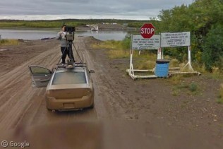
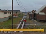
To finish your Dempster journey, you must cross both the Peel River at Fort McPherson and the second-longest river in North America, the Mackenzie, at Tsiigehtchic. In winter, this must be done by driving over the river when it’s frozen. In summer, a ferry completes the job for you. Waiting for the boat provides a good opportunity for the Street View driver to perform some camera maintenance.
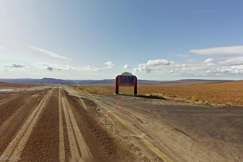
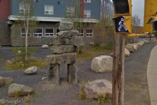
At the end of the highway lies the town of Inuvik, the most northerly Canadian town captured by Street View, whose cameras are greeted at the entrance to town by a traditional inuksuk (Wikipedia). Inuvik is most famous for Our Lady of Victory Church, built in the form of an igloo.

Despite its remote location (and the fact that all buildings must be built upon small stilts in order not to melt into the permafrost below), Inuvik is a rather modern town. Since it can’t sink its utilities into the ground, the town’s water lines are connected above ground with small bridges and overpasses built to cross them. We end our northern journey with the answer to the question you’ve all been asking: Is it possible to play miniature golf in the Arctic?
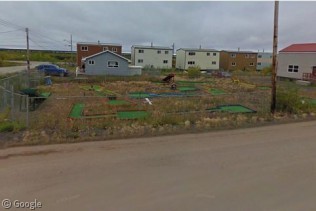
It most certainly is.
About the author
Kyle is a jack-of-all-trades geographer and archivist in rural British Columbia and was formerly the proprietor of humble geography blog The Basement Geographer. He enjoys a good game of hockey and a good 30-km walk with a frozen beverage in hand.

Incredible tour Kyle – absolutely stunning landscapes!
Thanks, Alex! I wasn’t very productive the day I wrote that article – all I did was gawk at the amazing scenery for hours!
Another excellent article, Kyle. I’ve noticed that the Street View cars seem to travel in tandem in extremely remote locations, which I’m guessing is a safety precaution. No doubt the redundancy would be useful if there were an equipment or transportation failure. It’s not like they could easily get to the shop. I’ve observed same thing along the Dalton Highway leading to Deadhorse, Alaska, as an example. Your image is the first time I’ve caught a glimpse of one of the Street View drivers, though!
And if you look around in that same spot, you can see an extreme closeup of the current car’s driver too, also performing maintenance. Looks like he’s cleaning the lenses.